Viewing entries in
Environmental Services

Wetland Mitigation Banking: A Path to Environmental and Financial Gains

Wetland Mitigation Banking: A Path to Environmental and Financial Gains

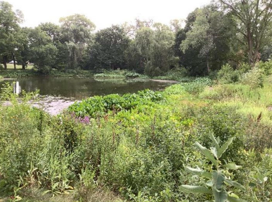
Wetland mitigation banking offers a promising solution to compensate for the loss of wetlands due to activities like municipal construction, private development, or agriculture. By restoring, creating, or enhancing wetland areas, these mitigation banks provide credits that developers can purchase to offset the environmental impacts of their projects. Instead of individually restoring wetlands for each project—a costly and complex task—developers can buy credits from established banks, streamlining the process and meeting environmental regulations more efficiently.

Protecting Wisconsin’s Bats: Essential Guidelines for Project Developers

Protecting Wisconsin’s Bats: Essential Guidelines for Project Developers

Why Are We So Concerned About Bats?

Bats play a crucial role in ecosystems by consuming agricultural and forest pests and acting as predators of biting insects. They also help reduce the spread of insect-borne diseases like the West Nile Virus. However, since 2014, bat populations in Wisconsin have been rapidly declining due to a fungal disease that causes high mortality rates among cave-dwelling bats.

This disease, known as White-Nose Syndrome (WNS), was first identified in New York in 2006 and has since spread across the U.S., reaching Wisconsin in 2014. WNS has led to the most significant decline in North American wildlife ever recorded, impacting many species of cave-hibernating bats. Some populations have experienced nearly 100% declines. In Wisconsin, WNS poses a severe threat to all four cave bat species: the Big Brown Bat, Little Brown Bat, Northern Long-Eared Bat (NLEB), and Tricolored Bat.

What Does This Mean for Your Project?

Due to the significant decline in Wisconsin’s cave-dwelling bat populations, all municipal projects must undergo a review to assess potential impacts on bats. This review is required before proceeding with later phases of the project. Identifying whether your project area contains suitable habitat for NLEBs can help expedite the permitting process.

Private development, agriculture, and utility projects do not require approval, but municipal projects do. Approval from both the state and federal governments is required before the project can begin.

  • Federal Approval: U.S. Fish and Wildlife Service (via the Information for Planning and Consultation Determination Key; IPaC DKey)

  • State Approval: Wisconsin Department of Natural Resources (via the Natural Heritage Inventory; NHI)

To avoid delays, aim to get approval from the IPaC DKey and NHI early in the project design phase (around 30% completion).

Does Your Project Area Have a Potential Habitat for Northern Long-Eared Bats (NLEBs)?

Suitable HabitatS

Trees and snags with a diameter of 3 inches or greater at breast height (dbh) that feature exfoliating bark, cracks, crevices, and/or cavities provide suitable habitat. Bats typically roost singly or in maternity colonies under bark or more often in cavities or crevices of live trees and snags. Suitable roosting habitats must be within 1,000 feet of a forest.

Other potential roosting sites include:

  • Bridges

  • Covered bridges

  • Culverts taller than 4 feet and longer than 130 feet

  • Old structures

Not Suitable Habitats

  • Trees located more than 1,000 feet from forested areas

  • Trees in predominantly urban, developed areas

  • Pure stands of trees less than 3 inches in dbh that lack larger trees

What If Your Project Is Not Cleared of Bat Habitat?

  1. Contact Your Environmental Consultant: They can provide options, such as performing field surveys, to determine whether bat habitat is present in the project area.

  2. Potential Roost/Habitat Survey: A trained biologist can assess the project area to confirm the presence of suitable habitat. Additional coordination with the USFWS/WDNR may be required for a final determination.

  3. Conservation Measures: If habitat is present, measures such as tree clearing during the winter (August 16 to May 31) may allow the project to proceed without further conditions.

  4. Habitat Conservation Plan: If impacts on bat habitat cannot be avoided, the existing habitat must be replaced or mitigated, typically at a 2:1 ratio. A mitigation plan must be submitted to the USFWS, and incidental take permits may be pursued through the WDNR.


R/m can help!

Do you need a review to assess the potential impact on bats on your future project site? Contact one of our experts today!


About the Author

Nicholas P. Connor, MS

Senior Biologist

Nick is a Senior Biologist with more than 10 years of experience managing and completing complex ecological-related projects from both public and private sector clients. He conducts or evaluates projects involving wetland delineations, potential wetland mitigation needs, cultural resource screens, archaeological reports, threatened and endangered (T&E) species reports, and storm water/erosion control plans.

Meeting Water Quality Requirements in Your Community

Meeting Water Quality Requirements in Your Community

Maintaining water quality is essential for the health and safety of any community, particularly for those that are classified as Municipal Separate Storm Sewer System (MS4) communities or are governed by Total Maximum Daily Loads (TMDLs). These designations bring with them a set of stringent requirements to prevent pollution from contaminating local water bodies. Meeting these standards not only ensures compliance with environmental regulations but also contributes to the broader goal of protecting natural resources for current and future generations.

Complying with Threatened and Endangered Species Protections

Complying with Threatened and Endangered Species Protections

Thinking about a new project but worried it might impact endangered species? This guide will help you navigate the state and federal regulations protecting these vulnerable creatures. Learn about the key steps involved in the review process, from initial screening to permits, and discover how to avoid project delays.

Growing Together: Leveraging Forestry Grants & GIS

Growing Together: Leveraging Forestry Grants & GIS

Forestry grants play a crucial role in helping municipalities fund the development and maintenance of community forestry programs. This includes activities such as tree inventories, plantings, pruning, invasive species control, and other sustainable practices. Additionally, leveraging GIS to maintain accurate tree data keeps tree inventories and forestry management plans accurate and efficient. By combining these two tools, municipalities can effectively maintain the health and resilience of their forest ecosystems.

Complying with MS4 Annual Reports

Complying with MS4 Annual Reports

The Wisconsin Department of Natural Resources (WDNR) required Municipal Separate Storm Sewer (MS4) annual report is coming due on March 31, 2024. Compiling the list of various MS4 compliance items performed throughout 2023 can be a challenge. We’ve created a summary of what to expect on this year’s report.

Wetland and Waterway Rules: What You Need to Know for Construction in 2024

Wetland and Waterway Rules: What You Need to Know for Construction in 2024

The defining jurisdictional boundary of the Waters of the United States (WOTUS) has been in contention since the Clean Water Act of 1972. In August of 2023, the jurisdictional boundary of the Waters of the United States were appended to meet the Sackett v. EPA Supreme Court decision. Learn what this ruling means for the future of your projects.

Honey Creek Restoration - Serving Function and Form

Honey Creek Restoration - Serving Function and Form

The Honey Creek Headwaters and Stream Restoration Project is the revitalization of the City of Greenfield’s most commonly used park – Konkel Park. The project area included a 0.92-mile segment of Honey Creek that had been overgrown with buckthorn, filled with sediment, and had no natural inputs. Using natural channel design, the streams are now operating hydraulically like a normal stream.

How the Northern Long-Eared Bat Could Impact Your Projects

How the Northern Long-Eared Bat Could Impact Your Projects

On November 29, 2022 the Northern Long-Eared Bat was reclassified as endangered. Project proponents must receive concurrence from both the State and Federal Government prior to the start of the project. Learn what this means for your project and how to implement conservation measures.

Discussion and Implications of the Waters of the US Rule

Discussion and Implications of the Waters of the US Rule

On December 30, 2022, the Environmental Protection Agency and the United States Army Corps of Engineers announced the final “Revised Definition of ‘Waters of the United States’” rule. This new rule will be effective on March 20, 2023. The following is an overview summary of similarities, changes, and how to move forward.

Improve Communication with Residents by Creating a GIS Hub Site

Improve Communication with Residents by Creating a GIS Hub Site

Municipalities are always looking for ways to improve how they share and communicate with their residents. With the emergence of ArcGIS Hub sites, R/M has helped several communities do just that. Common inquiries by residents about geographical information such as garbage collection, zoning codes, and snowplow routes can be answered through information accessed in their municipality’s Hub site.

How To Know A Stream Restoration Project When You See One

How To Know A Stream Restoration Project When You See One

Stream restoration is a technique that stabilizes channels in the current environment while working to accomplish common goals like reducing erosion of the channel beds and banks, improving water quality, and improving in-stream habitats. Learn what to look for, funding sources, and how your community can fund from a stream restoration.

How MMSD Streamlined Their Green Infrastructure Inspection Program

How MMSD Streamlined Their Green Infrastructure Inspection Program

The Milwaukee Metropolitan Sewerage District (MMSD) recently partnered with District landowners to install green infrastructure devices through the Green Infrastructure Partnership Program. The program was established to help MMSD reach its goal to implement 10 million gallons of green infrastructure annually and achieve TMDL compliance. Learn how R/M helped the District make progress towards those goals through an efficient, streamlined green infrastructure inspection and maintenance program.

Wetland Delineation Due Diligence and Site Determination

Wetland Delineation Due Diligence and Site Determination

If you are planning a project that may disturb, alter, or fill a wetland, stream, pond, or shoreline, you will need a wetland delineation. Learn why conducting due diligence and completing preliminary environmental assessments early in the project planning phase can make or break your project’s timeline and budget.

USDA Financing for Solar Energy Projects in Rural Communities

USDA Financing for Solar Energy Projects in Rural Communities

Renewable energy initiatives and opportunities are growing throughout the Midwest. Various types of organizations, both private and municipal, are evaluating open agricultural lands, under-utilized brownfields, closed landfills, and other open space for the potential installation of ground-mounted solar generation and battery storage projects. However, these initiatives like other projects, often come up against funding hiccups.

7 Tips to Secure Grant Funding For Your Next Project

7 Tips to Secure Grant Funding For Your Next Project

Many essential municipal projects cannot be realized without the help of grant funding, but the process of securing these funds can be overwhelming. Our experts created these 7 tips to help your team navigate the application process, stay organized, and get your project funded.

Early Bird Gets The Worm: It's Time for a Wetland Delineation

Early Bird Gets The Worm: It's Time for a Wetland Delineation

With the promise of sunshine and spring flowers ahead, it’s time to line up the field surveys needed for project approvals. To avoid unanticipated delays, wetland and other environmental screenings and/or field work should be handled early in the project design process. Set your next project up for success and learn the who, what, where, and why of wetland delineations.

Avoid Delays with an Assured Wetland Delineator

Avoid Delays with an Assured Wetland Delineator

It’s tough to imagine on these beautiful summer days, but fall is fast approaching, and now is the time to schedule necessary wetland delineations for your development project. Learn how you can avoid the long WDNR approval process and get a head start on your project’s planning, design, and permitting by working with our Professionally Assured Wetland Delineator.

The Bad and the Ugly: What Happens When You Don't Pay Attention to Erosion Control

The Bad and the Ugly: What Happens When You Don't Pay Attention to Erosion Control

Failure to select and install the appropriate BMPs for your construction project will do more than negatively impact the health of our rivers, streams, and lakes. From hefty fines to project delays, here are the consequences developers and municipalities may face for failure to properly implement erosion and sediment control BMPs.